Hornberget hiking trail
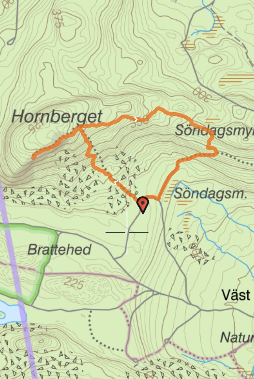
Road from Västerstråsjö about 2 km west.
Drive towards Gladbäckens nature reserve and the Exercise centre.
Follow the arrows Hornberget.
The mountain measures approx. 444 m above sea level.
At the top there is a cabin and here the view
over the valley to the east is fantastic.
You can see the Dellensjöarna lakes in the back in the beautiful view.
Hiking.
You can start at different places depending on how far
or how steep the climb is you want.
Starting point 1.
1.4 km steep climb almost all the way up.
A magical path with old forest winds up the mountain.
Starting point 2.
2.6 km, same place as 1.
Now take the road to the right and follow the markings
that lead up the mountain on the east side.
More steep where you follow an old road.
You can also take the car to the turnoff
then the hike will be shortened by about 500 m.
A tip is to take the steep part up and the easier part down
as it can be more difficult to go down steep sections.
Length of the trail
Starting point 1.
1.4 km steep climb
Starting point 2.
2.6 km easier climb
Another tip if you want a longer hike,
is to park your car at the Fitness Center
and follow the trail that goes towards Hornberget.
There is a map at the center.
If you want to walk really far, you can park at Ängbo IK's clubhouse in Ängebo,
hiking center, walk over the ski and hiking bridge.
Take the small gravel road to the right,
and then left to get to the main road,
and follow it all the way to the starting point at Hornberget.
A distance of about 5 km.

